Geolocate

Poetry topographic map

Click on the map to display elevation.

About this map

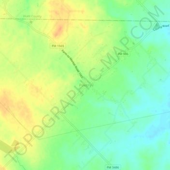
Name: Poetry topographic map, elevation, terrain.

Location: Poetry, Kaufman County, Texas, United States (32.80568 -96.26581 32.84568 -96.22581)

Average elevation: 554 ft

Minimum elevation: 499 ft

Maximum elevation: 610 ft

Kaufman County trails, hiking, mountain biking, running and outdoor activities

Other topographic maps

Click on a map to view its topography, its elevation and its terrain.

Forney

United States > Texas > Kaufman County

Average elevation: 446 ft

Mabank

United States > Texas > Kaufman County

Average elevation: 374 ft

Terrell

United States > Texas > Kaufman County

Average elevation: 502 ft

Terrell

United States > Texas > Kaufman County

Average elevation: 502 ft

Forney

United States > Texas > Kaufman County

Average elevation: 446 ft

Crandall

United States > Texas > Kaufman County

Average elevation: 397 ft

Terrell

United States > Texas > Kaufman County

Average elevation: 502 ft

Gear up for your next adventure:

🧯Emergency Survival Kit - All‑in‑one survival essentials for the backcountry
🧯Portable Fire Pit - Compact fire pit for camping spots
🗻Climbing Gear Basics - Essential gear for beginner climbers
🏔️Mountain Trail Maps - High‑detail maps for popular peaks
🔊Portable Camp Speaker - Music and alerts at camp

As an Amazon Associate, this site earns from qualifying purchases at no extra cost to you.