Geolocate

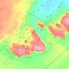
Ash Sheikh Zayed topographic map

Click on the map to display elevation.

About this map
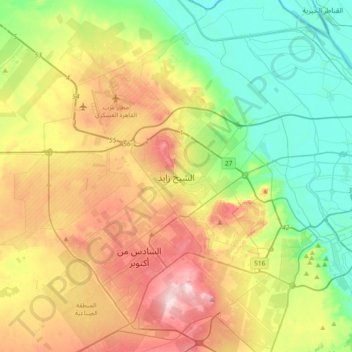
Name: Ash Sheikh Zayed topographic map, elevation, terrain.

Location: Ash Sheikh Zayed, Giza, 12588, Egypt (29.88533 30.81975 30.20533 31.13975)

Average elevation: 344 ft

Minimum elevation: 16 ft

Maximum elevation: 866 ft

Other topographic maps

Click on a map to view its topography, its elevation and its terrain.
Giza Pyramids

Egypt > Giza > Giza

Average elevation: 213 ft

Wadi Al-Hitan (Whale Valley)

Egypt > Giza

Average elevation: 318 ft

Giza Pyramids

Egypt > Giza > Giza

Average elevation: 213 ft

Sheikh Zayed

Egypt > Giza

Average elevation: 400 ft

Giza Pyramids

Egypt > Giza > Giza

Average elevation: 213 ft

Al Haraneya Village

Egypt > Giza

Average elevation: 62 ft

Jazirat Warraq al Hadar

Egypt > Giza > Tanaash

Average elevation: 66 ft

Kerdasa City

Egypt > Giza > Kirdasah

Average elevation: 92 ft

Abo Al Nomros City

Egypt > Giza > Abu An Numrus

Average elevation: 66 ft

Ard Al Lwaa'

Egypt > Giza > Nazlet Bahgat

Average elevation: 75 ft

Al Mounib

Egypt > Giza

Average elevation: 72 ft

City View

Egypt > Giza

Average elevation: 213 ft

Gezirat Dahab

Egypt > Giza

Average elevation: 69 ft

Ard Al Lwaa'

Egypt > Giza > Nazlet Bahgat

Average elevation: 75 ft

Gear up for your next adventure:

🏥Hiking First Aid Kits - Comprehensive medical kits for remote trail injuries
🛠️Outdoor Gear Repair Kit - Essential tools to fix gear on the trail
🧼Biodegradable Camping Soap - Eco‑friendly soap for outdoor hygiene
🪶Wildlife Field Guides - Learn animal tracking and species ID
🧷Carabiner Set - Durable clips for gear attachment

As an Amazon Associate, this site earns from qualifying purchases at no extra cost to you.