Geolocate

Lipan topographic map

Click on the map to display elevation.

About this map

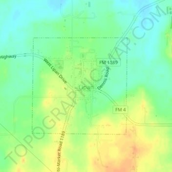
Name: Lipan topographic map, elevation, terrain.

Location: Lipan, Hood County, Texas, United States (32.51102 -98.05594 32.52621 -98.03823)

Average elevation: 922 ft

Minimum elevation: 873 ft

Maximum elevation: 978 ft

Hood County trails, hiking, mountain biking, running and outdoor activities

Other topographic maps

Click on a map to view its topography, its elevation and its terrain.

Paluxy

United States > Texas > Hood County

Average elevation: 833 ft

Acton

United States > Texas > Hood County

Average elevation: 797 ft

Pecan Plantation

United States > Texas > Hood County

Average elevation: 702 ft

Cresson

United States > Texas > Hood County

Average elevation: 994 ft

Oak Trail Shores

United States > Texas > Hood County

Average elevation: 758 ft

Gear up for your next adventure:

🥤Water Filter Bottle - All‑in‑one filter bottle for safe hydration
🗺️Topographic Maps - Detailed topo maps for hiking, exploring and outdoor navigation
🌡️Handheld Weather Meters - Measure wind, temp, and pressure for safe mountain travel
🧷Carabiner Set - Durable clips for gear attachment
🪶Trail Camera - Capture wildlife on your hikes

As an Amazon Associate, this site earns from qualifying purchases at no extra cost to you.