Geolocate

Geronimo topographic map

Click on the map to display elevation.

About this map

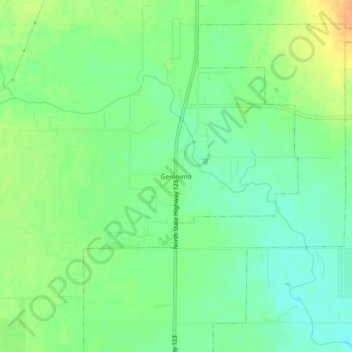
Name: Geronimo topographic map, elevation, terrain.

Location: Geronimo, Guadalupe County, Texas, 78115, United States (29.64300 -97.98695 29.68300 -97.94695)

Average elevation: 591 ft

Minimum elevation: 541 ft

Maximum elevation: 659 ft

Guadalupe County trails, hiking, mountain biking, running and outdoor activities

Other topographic maps

Click on a map to view its topography, its elevation and its terrain.

Santa Clara

United States > Texas > Guadalupe County

Average elevation: 719 ft

New Berlin

United States > Texas > Guadalupe County

Average elevation: 558 ft

Marion

United States > Texas > Guadalupe County

Average elevation: 640 ft

Kingsbury

United States > Texas > Guadalupe County > Kingsbury

Average elevation: 545 ft

Gear up for your next adventure:

🧴Hand Sanitizer - Keep hands clean while hiking
🔭Telescopic Hiking Pole - Adjustable pole for hiking stability
🚪Portable Camp Chair - Foldable chair for comfort at camp
🎁Geography Themed Gifts - Unique gift ideas for map lovers and geography enthusiasts
🥩Freeze-Dried Meals - Nutritious and lightweight food for remote expeditions

As an Amazon Associate, this site earns from qualifying purchases at no extra cost to you.