Geolocate

Zack topographic map

Click on the map to display elevation.

About this map

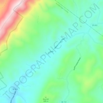
Name: Zack topographic map, elevation, terrain.

Location: Zack, Rockbridge County, Virginia, United States (37.97291 -79.38087 38.01291 -79.34087)

Average elevation: 1,778 ft

Minimum elevation: 1,283 ft

Maximum elevation: 3,031 ft

Rockbridge County trails, hiking, mountain biking, running and outdoor activities

Other topographic maps

Click on a map to view its topography, its elevation and its terrain.

Goshen

United States > Virginia > Rockbridge County

Average elevation: 1,549 ft

Glasgow

United States > Virginia > Rockbridge County

Average elevation: 932 ft

Hays Creek

United States > Virginia > Rockbridge County

Average elevation: 1,437 ft

Gear up for your next adventure:

🧣Merino Neck Gaiters - Multi-functional headwear for wind and sun protection
🎒Day Hiking Backpack - Lightweight backpack perfect for day trips and outdoor adventures
🌲Outdoor Survival Books - Best books on survival skills
🕶️Glacier Sunglasses - Side shields to protect eyes from high-altitude snow glare
Solar GPS Watches - Advanced multisport watches with built-in topographic maps

As an Amazon Associate, this site earns from qualifying purchases at no extra cost to you.