
Goshen topographic map
Click on the map to display elevation.
About this map
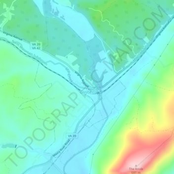
Name: Goshen topographic map, elevation, terrain.
Location: Goshen, Rockbridge County, Virginia, United States (37.97289 -79.53468 38.00327 -79.48721)
Average elevation: 1,549 ft
Minimum elevation: 1,355 ft
Maximum elevation: 2,215 ft
Rockbridge County trails, hiking, mountain biking, running and outdoor activities
Other topographic maps
Click on a map to view its topography, its elevation and its terrain.