
Thank you for supporting this site ❤️
Make a donation
Make a donation
Gear up for your next adventure:
As an Amazon Associate, this site earns from qualifying purchases at no extra cost to you.
Ansley topographic map
Click on the map to display elevation.
Thank you for supporting this site ❤️
Make a donation
Make a donation
Gear up for your next adventure:
As an Amazon Associate, this site earns from qualifying purchases at no extra cost to you.
About this map
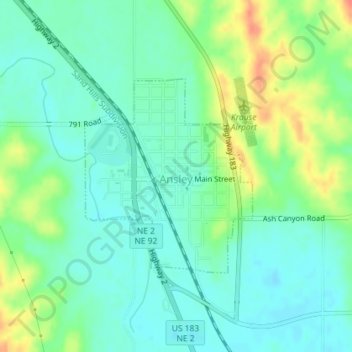
Name: Ansley topographic map, elevation, terrain.
Location: Ansley, Custer County, Nebraska, 68814, United States (41.28072 -99.39112 41.29563 -99.37395)
Average elevation: 2,333 ft
Minimum elevation: 2,280 ft
Maximum elevation: 2,441 ft
Thank you for supporting this site ❤️
Make a donation
Make a donation
Gear up for your next adventure:
As an Amazon Associate, this site earns from qualifying purchases at no extra cost to you.