Geolocate

Tolyatti topographic map

Click on the map to display elevation.

About this map

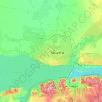
Name: Tolyatti topographic map, elevation, terrain.

Location: Tolyatti, Samara Oblast, Volga Federal District, Russia (53.44636 49.19282 53.59726 49.77655)

Average elevation: 322 ft

Minimum elevation: 79 ft

Maximum elevation: 1,155 ft

Gear up for your next adventure:

🥾Women's Hiking Boots - Top-rated trail boots with ankle support and superior grip
🏥Hiking First Aid Kits - Comprehensive medical kits for remote trail injuries
🛡️Insect Repellent - Protection against bugs during outdoor activities
🕶️GPS Smartphone Mount - Secure mount for phone navigation
🗺️Topographic Maps - Detailed topo maps for hiking, exploring and outdoor navigation

As an Amazon Associate, this site earns from qualifying purchases at no extra cost to you.