Geolocate

Chimney Rock Park topographic map

Click on the map to display elevation.

About this map
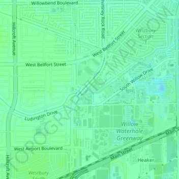
Name: Chimney Rock Park topographic map, elevation, terrain.

Location: Chimney Rock Park, 11655, Houston, Harris County, Texas, 77035, United States (29.65270 -95.48049 29.65401 -95.47799)

Average elevation: 69 ft

Minimum elevation: 52 ft

Maximum elevation: 79 ft

Harris County trails, hiking, mountain biking, running and outdoor activities

Other topographic maps

Click on a map to view its topography, its elevation and its terrain.

Almeda Plaza

United States > Texas > Harris County > Houston

Average elevation: 56 ft

East Haven

United States > Texas > Harris County > Houston

Average elevation: 43 ft

Kingwood

United States > Texas > Harris County > Houston

Average elevation: 72 ft

Hudson

United States > Texas > Harris County > Houston

Average elevation: 102 ft

Moonshine Hill

United States > Texas > Harris County > Houston

Average elevation: 72 ft

Clear Lake City

United States > Texas > Harris County > Houston

Average elevation: 26 ft

Lake Houston

United States > Texas > Harris County > Houston

Average elevation: 66 ft

Kings Point

United States > Texas > Harris County > Houston

Average elevation: 66 ft

Trailwood Village

United States > Texas > Harris County > Houston

Average elevation: 82 ft

Minnetex

United States > Texas > Harris County > Houston

Average elevation: 52 ft

Harrisburg

United States > Texas > Harris County > Houston > Harrisburg

Average elevation: 33 ft

Greentree

United States > Texas > Harris County > Houston > Greentree

Average elevation: 75 ft

Golfcrest

United States > Texas > Harris County > Houston

Average elevation: 39 ft

Foster Place

United States > Texas > Harris County > Houston

Average elevation: 49 ft

Magnolia Park

United States > Texas > Harris County > Houston

Average elevation: 33 ft

Olcott

United States > Texas > Harris County > Houston

Average elevation: 33 ft

Dogwood Acres

United States > Texas > Harris County > Houston

Average elevation: 72 ft

Addicks Reservoir

United States > Texas > Harris County > Houston

Addicks Reservoir is formed by a rolled earthen dam 61,666 feet (18,796 m) long and above the streambed. A 12-foot-wide (3.7 m) gravel road extends along the top of the dam. The top of the dam has a maximum elevation of 121 feet (37 m) above the NAVD 1988 and is almost 50 feet high in points. The maximum…

Average elevation: 102 ft

Lakewood Heights

United States > Texas > Harris County > Houston

Average elevation: 59 ft

Mykawa

United States > Texas > Harris County > Houston > Mykawa

Average elevation: 49 ft

Gear up for your next adventure:

🚑Emergency Bivvies - Heat-reflective sleeping bags for survival situations
🔥Fast-Boil Camping Stoves - Efficient cooking systems for quick trail meals
🪶Paracord Bracelet - Survival bracelet with built‑in tools
🥩Freeze-Dried Meals - Nutritious and lightweight food for remote expeditions
🚁Photography Drones - Capture stunning aerial views of landforms and topography

As an Amazon Associate, this site earns from qualifying purchases at no extra cost to you.