
Donaustadt topographic map
Interactive map
Click on the map to display elevation.
About this map
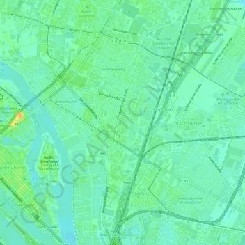
Name: Donaustadt topographic map, elevation, terrain.
Location: Donaustadt, Neukagran, Wien, 1220, Österreich (48.21544 16.42845 48.25544 16.46845)
Average elevation: 528 ft
Minimum elevation: 495 ft
Maximum elevation: 600 ft
Other topographic maps
Click on a map to view its topography, its elevation and its terrain.