Geolocate

Manitou topographic map

Click on the map to display elevation.

About this map

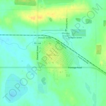
Name: Manitou topographic map, elevation, terrain.

Location: Manitou, Division No. 4, Manitoba, R0G 1G0, Canada (49.23295 -98.54522 49.24782 -98.52225)

Average elevation: 1,598 ft

Minimum elevation: 1,565 ft

Maximum elevation: 1,644 ft

Other topographic maps

Click on a map to view its topography, its elevation and its terrain.

St. Leon

Canada > Manitoba > Division No. 4 > Municipality of Lorne

Average elevation: 1,627 ft

Gear up for your next adventure:

🛡️Insect Repellent - Protection against bugs during outdoor activities
📶Vehicle Signal Boosters - Improve reception in rural areas while driving to trailheads
🦶Hiking Gaiters - Keep debris and water out of your boots
🎒Outdoor Daypacks - Lightweight backpacks designed for carrying maps and essential gear
🎒Day Hiking Backpack - Lightweight backpack perfect for day trips and outdoor adventures

As an Amazon Associate, this site earns from qualifying purchases at no extra cost to you.