
Callaway topographic map
Click on the map to display elevation.
About this map
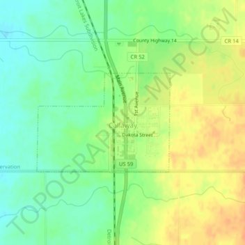
Name: Callaway topographic map, elevation, terrain.
Location: Callaway, Becker County, Minnesota, United States (46.97728 -95.92367 46.98818 -95.90215)
Average elevation: 1,375 ft
Minimum elevation: 1,319 ft
Maximum elevation: 1,434 ft
Becker County trails, hiking, mountain biking, running and outdoor activities
Other topographic maps
Click on a map to view its topography, its elevation and its terrain.
Detroit Lakes
United States > Minnesota > Becker County > Detroit Lakes > Detroit Lakes
Average elevation: 1,362 ft