Geolocate

Middle Point topographic map

Click on the map to display elevation.

About this map

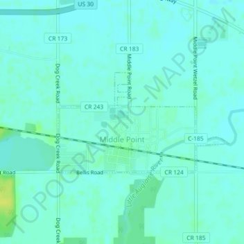
Name: Middle Point topographic map, elevation, terrain.

Location: Middle Point, Van Wert County, Ohio, United States (40.85194 -84.45653 40.86299 -84.43148)

Average elevation: 778 ft

Minimum elevation: 764 ft

Maximum elevation: 820 ft

Van Wert County trails, hiking, mountain biking, running and outdoor activities

Other topographic maps

Click on a map to view its topography, its elevation and its terrain.

Wolfcale

United States > Ohio > Van Wert County

Average elevation: 804 ft

Gear up for your next adventure:

🛡️Bear Spray Outdoor - Protection in bear country hikes
🔌USB Car Charger - Car charger for on‑the‑go power needs
🧭Pro Hiking Compasses - High-accuracy liquid-filled compasses for topographic orientation
👟Trail Running Shoes - Lightweight shoes for trail runners
🧯Emergency Survival Kit - All‑in‑one survival essentials for the backcountry

As an Amazon Associate, this site earns from qualifying purchases at no extra cost to you.