Geolocate

Lent topographic map

Click on the map to display elevation.

About this map

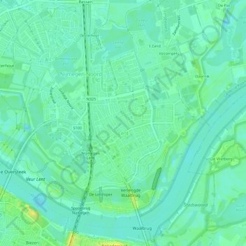
Name: Lent topographic map, elevation, terrain.

Location: Lent, Nijmegen-Noord, Nijmegen, Gelderland, Netherlands (51.85131 5.83144 51.88039 5.88677)

Average elevation: 36 ft

Minimum elevation: 13 ft

Maximum elevation: 79 ft

Gear up for your next adventure:

🛏️Cold Weather Sleeping Bag - Warm sleeping bag for cold conditions
🛡️Insect Repellent - Protection against bugs during outdoor activities
🔥Camping Stove - Portable stove for camping and backcountry cooking
🎁Geography Themed Gifts - Unique gift ideas for map lovers and geography enthusiasts
❄️Traction Cleats - Prevent slips on icy trails during winter hikes

As an Amazon Associate, this site earns from qualifying purchases at no extra cost to you.