Geolocate

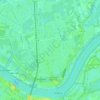
Nijmegen topographic maps

Click on a map to view its topography, its elevation and its terrain.

Lent

Netherlands > Gelderland > Nijmegen

Average elevation: 36 ft

Gear up for your next adventure:

🗺️NatGeo Topo Maps - High-quality waterproof printed topographic maps of US Parks
🪄Magnetic Compass - Accurate compass for navigation
🛌Ultralight Sleeping Bags - Compact down bags for cold nights in the wilderness
🥘Titanium Cookware - Durable, featherlight pots and pans for backpacking
📦Gear Storage Bags - Organize and protect outdoor equipment

As an Amazon Associate, this site earns from qualifying purchases at no extra cost to you.