Geolocate

Billinghay topographic map

Click on the map to display elevation.

Billinghay

The settlement is mentioned in the Domesday Book. The name originates from a Saxon name for a fishery. The topography in ancient times would have been that of a small settlement on a gravel mound surrounded by marsh which was flooded in winter. After the draining of the fens in the late 18th century the area became rich agricultural land as it is today.

Wikipedia (CC-BY-SA 3.0)

About this map

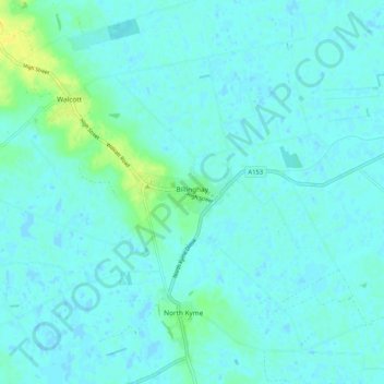
Name: Billinghay topographic map, elevation, terrain.

Location: Billinghay, North Kesteven, Lincolnshire, England, United Kingdom (53.05853 -0.31691 53.10060 -0.21331)

Average elevation: 13 ft

Minimum elevation: -3 ft

Maximum elevation: 62 ft

Other topographic maps

Click on a map to view its topography, its elevation and its terrain.

Eagle

United Kingdom > England > Lincolnshire > North Kesteven

Average elevation: 56 ft

Whisby

United Kingdom > England > Lincolnshire > North Kesteven

Average elevation: 69 ft

Howell

United Kingdom > England > Lincolnshire > North Kesteven > Ewerby

Average elevation: 30 ft

Cranwell

United Kingdom > England > Lincolnshire > North Kesteven

Average elevation: 151 ft

Aswarby

United Kingdom > England > Lincolnshire > North Kesteven

Average elevation: 69 ft

Quarrington

United Kingdom > England > Lincolnshire > North Kesteven

According to the Köppen classification, the British Isles experience a maritime climate characterised by relatively cool summers and mild winters. Lincolnshire's position on the east of the Isles allows for a sunnier and warmer climate relative to the national average, and it is one of the driest counties in…

Average elevation: 69 ft

Nocton

United Kingdom > England > Lincolnshire > North Kesteven

Average elevation: 69 ft

Ewerby

United Kingdom > England > Lincolnshire > North Kesteven

Average elevation: 36 ft

Branston

United Kingdom > England > Lincolnshire > North Kesteven

Average elevation: 131 ft

Greylees

United Kingdom > England > Lincolnshire > North Kesteven

Average elevation: 95 ft

Leadenham

United Kingdom > England > Lincolnshire > North Kesteven

Average elevation: 157 ft

Coleby

United Kingdom > England > Lincolnshire > North Kesteven

Average elevation: 164 ft

Spanby

United Kingdom > England > Lincolnshire > North Kesteven

Average elevation: 59 ft

Welbourn

United Kingdom > England > Lincolnshire > North Kesteven

Average elevation: 164 ft

Kelby

United Kingdom > England > Lincolnshire > North Kesteven

Average elevation: 223 ft

Dunston

United Kingdom > England > Lincolnshire > North Kesteven

Average elevation: 69 ft

Anwick

United Kingdom > England > Lincolnshire > North Kesteven

Average elevation: 23 ft

Sutton

United Kingdom > England > Lincolnshire > North Kesteven > Sutton

Average elevation: 56 ft

Martin

United Kingdom > England > Lincolnshire > North Kesteven

Average elevation: 33 ft

Walcott

United Kingdom > England > Lincolnshire > North Kesteven

Average elevation: 23 ft

Gear up for your next adventure:

🛡️Bear Spray Outdoor - Protection in bear country hikes
🛏️Cold Weather Sleeping Bag - Warm sleeping bag for cold conditions
🪶Survival Guide Book - Expert advice for emergency preparedness
🦺Reflective Outdoor Gear - Safety gear for low‑light conditions
🔥Plasma Lighters - Windproof lighters that work in any weather condition

As an Amazon Associate, this site earns from qualifying purchases at no extra cost to you.