
Toravalli topographic map
Click on the map to display elevation.
About this map
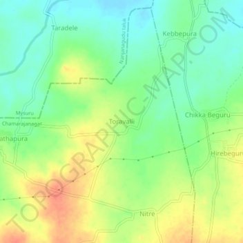
Name: Toravalli topographic map, elevation, terrain.
Location: Toravalli, Gundlupet taluk, Chamarajanagar, Karnataka, India (11.96439 76.71117 12.00439 76.75117)
Average elevation: 2,369 ft
Minimum elevation: 2,297 ft
Maximum elevation: 2,461 ft
Other topographic maps
Click on a map to view its topography, its elevation and its terrain.
Bandipur National Park
India > Karnataka > Gundlupet taluk
Bandipur National Park is located between 75° 12’ 17" E to 76° 51’ 32" E and 11° 35’ 34" N to 11° 57’ 02" N where the Deccan Plateau meets the Western Ghats, and the altitude of the park ranges from 680 m (2,230 ft) to 1,454 m (4,770 ft). As a result, the park has a variety of biomes including dry…
Average elevation: 2,822 ft