Geolocate

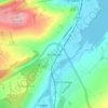
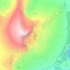
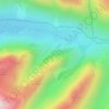
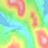
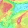
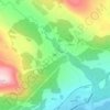
Elphin topographic map

Click on the map to display elevation.

About this map

Name: Elphin topographic map, elevation, terrain.

Location: Elphin, Highland, Scotland, IV27 4HH, United Kingdom (58.04498 -5.03935 58.06442 -5.01285)

Average elevation: 548 ft

Minimum elevation: 354 ft

Maximum elevation: 1,056 ft

Other topographic maps

Click on a map to view its topography, its elevation and its terrain.
Aviemore

United Kingdom > Scotland > Highland

Average elevation: 1,086 ft

the Black Isle

United Kingdom > Scotland > Highland

Average elevation: 269 ft

Skye

United Kingdom > Scotland > Highland

Beyond Loch Snizort to the west of Trotternish is the Waternish peninsula, which ends in Ardmore Point's double rock arch. Duirinish peninsula is separated from Waternish by Loch Dunvegan, which contains the island of Isay. It is ringed by sea cliffs that reach 296 metres (971 feet) on the west at Waterstein…

Average elevation: 207 ft
Loch Ness

United Kingdom > Scotland > Highland > Dores

Average elevation: 1,115 ft

Inverness

United Kingdom > Scotland > Highland

Average elevation: 535 ft

Fort William

United Kingdom > Scotland > Highland

Fort William has an oceanic climate (Cfb) with moderate, but generally cool, temperatures and abundant precipitation. In the towns immediate vicinity, there are significant variations in elevation, which leads to some uninhabited areas near the town having a subpolar oceanic climate (Cfc), or, at the absolute…

Average elevation: 400 ft
Ben Nevis

United Kingdom > Scotland > Highland

Ben Nevis has a highland (alpine) maritime (oceanic) polar climate (ET climate in the Köppen classification). Ben Nevis's elevation, maritime location and topography frequently lead to cool and cloudy weather conditions, which can pose a danger to ill-equipped walkers. According to the observations carried…

Average elevation: 2,992 ft
Scottish Highlands

United Kingdom > Scotland > Highland

The entire region was covered by ice sheets during the Pleistocene ice ages, save perhaps for a few nunataks. The complex geomorphology includes incised valleys and lochs carved by the action of mountain streams and ice, and a topography of irregularly distributed mountains whose summits have similar heights…

Average elevation: 2,976 ft

Annat

United Kingdom > Scotland > Highland

Average elevation: 499 ft

Maryburgh

United Kingdom > Scotland > Highland

Average elevation: 184 ft

Old Man of Storr

United Kingdom > Scotland > Highland

Average elevation: 1,161 ft

Tomich

United Kingdom > Scotland > Highland

Average elevation: 715 ft

River Findhorn

United Kingdom > Scotland > Highland

Average elevation: 912 ft

Newtonmore

United Kingdom > Scotland > Highland

Newtonmore is located within the Cairngorms National Park, approximately 3 miles (5 km) southwest of Kingussie and 15 miles (24 km) southwest of Aviemore. It is on the northeastern bank of the River Spey, between the River Calder and the Allt Lairaidh, at an altitude of approximately 250 metres (820 ft).

Average elevation: 928 ft

Loch Morar

United Kingdom > Scotland > Highland > Morar

Loch Morar (Scottish Gaelic: Loch Mòrair) is a freshwater loch in Lochaber, Highland, Scotland. It is the fifth-largest loch by surface area in Scotland, at 26.7 km2 (10.3 sq mi), and the deepest freshwater body in the British Isles with a maximum depth of 310 m (1,017 ft). The loch was created by glacial…

Average elevation: 387 ft

Loch Tarff

United Kingdom > Scotland > Highland

Average elevation: 1,056 ft

Ardgour

United Kingdom > Scotland > Highland

Average elevation: 771 ft

Kylesku

United Kingdom > Scotland > Highland

Average elevation: 269 ft

The Three Sisters

United Kingdom > Scotland > Highland

Average elevation: 1,407 ft

`Neist Point

United Kingdom > Scotland > Highland

Average elevation: 23 ft

North Ballachulish

United Kingdom > Scotland > Highland

Average elevation: 499 ft

Culloden

United Kingdom > Scotland > Highland

Average elevation: 167 ft

Kilmore

United Kingdom > Scotland > Highland > Ferindonald

Average elevation: 200 ft

River Fleet

United Kingdom > Scotland > Highland > Pittentrail

Average elevation: 577 ft

Big Sand

United Kingdom > Scotland > Highland > Big Sand

Average elevation: 121 ft

Applecross

United Kingdom > Scotland > Highland

Average elevation: 489 ft

Loch Eriboll

United Kingdom > Scotland > Highland

Average elevation: 344 ft

Tornagrain

United Kingdom > Scotland > Highland > Tornagrain

Average elevation: 167 ft

Rubha Reidh

United Kingdom > Scotland > Highland > Melvaig

Average elevation: 105 ft

Lentran

United Kingdom > Scotland > Highland > Inchmore

Average elevation: 177 ft

Loch Shiel

United Kingdom > Scotland > Highland > Acharacle

Average elevation: 951 ft

Loch Garten

United Kingdom > Scotland > Highland

Average elevation: 758 ft

Loch Affric

United Kingdom > Scotland > Highland

A number of smaller lochs surround Loch Affric. At the southwestern end sits Loch Coulavie located at the base An Tudair Beag and a slightly higher elevation. Also, at the southwestern end, the river Affric flows into the tiny loch of Loch na Camaig. At the northeastern side, Loch Pollan Fearna drains into…

Average elevation: 1,565 ft
Struanmor

United Kingdom > Scotland > Highland > Struan

Average elevation: 131 ft

Balgown

United Kingdom > Scotland > Highland > Struan

Average elevation: 190 ft

Invercassley

United Kingdom > Scotland > Highland > Rosehall

Average elevation: 141 ft

Loch of Wester

United Kingdom > Scotland > Highland

Average elevation: 36 ft

Coylumbridge

United Kingdom > Scotland > Highland > Aviemore

Average elevation: 860 ft

Loch Watten

United Kingdom > Scotland > Highland > Watten

Average elevation: 112 ft

Lochcarron

United Kingdom > Scotland > Highland

Average elevation: 220 ft

Eilean Shona

United Kingdom > Scotland > Highland

Average elevation: 161 ft

Abernethy Forest

United Kingdom > Scotland > Highland > Nethy Bridge

Average elevation: 1,115 ft

Slackbuie

United Kingdom > Scotland > Highland

Average elevation: 502 ft

Loch Garry

United Kingdom > Scotland > Highland

Average elevation: 978 ft

Loch Morlich

United Kingdom > Scotland > Highland > Glenmore

Average elevation: 1,138 ft

Eigg

United Kingdom > Scotland > Highland > Cleadale

Average elevation: 200 ft

Duncansby Head

United Kingdom > Scotland > Highland

Average elevation: 30 ft

Glasphein

United Kingdom > Scotland > Highland > Glendale

Average elevation: 341 ft

River Ness

United Kingdom > Scotland > Highland > Inverness

Average elevation: 226 ft

Loch Mullardoch

United Kingdom > Scotland > Highland

Average elevation: 2,005 ft

Kentra Bay

United Kingdom > Scotland > Highland

Average elevation: 66 ft

Loch Glass

United Kingdom > Scotland > Highland

Average elevation: 1,411 ft

Soay

United Kingdom > Scotland > Highland

Average elevation: 59 ft

Jules's

United Kingdom > Scotland > Highland > Aviemore

Average elevation: 1,191 ft

Kentra Moss

United Kingdom > Scotland > Highland > Acharacle

Average elevation: 52 ft

Raddery

United Kingdom > Scotland > Highland > Fortrose

Average elevation: 423 ft

Corpach

United Kingdom > Scotland > Highland

Average elevation: 272 ft

Ardnarff

United Kingdom > Scotland > Highland

Average elevation: 512 ft

Knoydart

United Kingdom > Scotland > Highland > Inverie

Average elevation: 709 ft

Langdale

United Kingdom > Scotland > Highland

Average elevation: 377 ft

Davochfin

United Kingdom > Scotland > Highland > Dornoch

Average elevation: 43 ft

Melvaig

United Kingdom > Scotland > Highland

Average elevation: 295 ft

Strathpeffer

United Kingdom > Scotland > Highland

It lies in a strath 5 miles (8 km) west of Dingwall, with the elevation ranging from 60 to 120 m (200 to 400 ft) above sea level. Sheltered on the west and north, it has a comparatively dry and warm climate.

Average elevation: 417 ft

Mellon Charles

United Kingdom > Scotland > Highland

Average elevation: 98 ft

Invermoriston

United Kingdom > Scotland > Highland

Average elevation: 696 ft

Sgùrr Alasdair

United Kingdom > Scotland > Highland

Average elevation: 1,890 ft

Glencoe

United Kingdom > Scotland > Highland

Average elevation: 374 ft

Avoch

United Kingdom > Scotland > Highland

Average elevation: 164 ft

Scotscalder

United Kingdom > Scotland > Highland

Average elevation: 236 ft

Wick

United Kingdom > Scotland > Highland

Average elevation: 66 ft

Kingussie

United Kingdom > Scotland > Highland

Average elevation: 1,109 ft

Lairg

United Kingdom > Scotland > Highland

Average elevation: 423 ft

Golspie Burn

United Kingdom > Scotland > Highland > Golspie

Average elevation: 486 ft

Insh

United Kingdom > Scotland > Highland

Average elevation: 902 ft

Lyth

United Kingdom > Scotland > Highland

Average elevation: 95 ft

Caol

United Kingdom > Scotland > Highland

Average elevation: 125 ft

Glasnakille

United Kingdom > Scotland > Highland

Average elevation: 128 ft

Ballachulish

United Kingdom > Scotland > Highland

Average elevation: 525 ft

Clachtoll

United Kingdom > Scotland > Highland

Average elevation: 125 ft

Brae Roy Lodge

United Kingdom > Scotland > Highland

Average elevation: 1,217 ft
Grampian Mountains

United Kingdom > Scotland > Highland

Average elevation: 2,543 ft

Sgùrr na Banachdich

United Kingdom > Scotland > Highland

Average elevation: 1,844 ft

Staffin

United Kingdom > Scotland > Highland

Average elevation: 138 ft

Dounreay

United Kingdom > Scotland > Highland

Average elevation: 118 ft

Inverinate

United Kingdom > Scotland > Highland

Average elevation: 610 ft

Tongue

United Kingdom > Scotland > Highland

Average elevation: 299 ft

Knockdee

United Kingdom > Scotland > Highland

Average elevation: 217 ft
North Watten

United Kingdom > Scotland > Highland

Average elevation: 167 ft
Poolewe

United Kingdom > Scotland > Highland

Average elevation: 190 ft

Altnaharra

United Kingdom > Scotland > Highland

Average elevation: 413 ft

Forsinard

United Kingdom > Scotland > Highland

Average elevation: 561 ft

Fearnmore

United Kingdom > Scotland > Highland

Average elevation: 72 ft

Milovaig

United Kingdom > Scotland > Highland

Average elevation: 236 ft

Sgùrr nan Gillean

United Kingdom > Scotland > Highland

Average elevation: 1,627 ft

Tarvie

United Kingdom > Scotland > Highland

Average elevation: 443 ft

The Storr

United Kingdom > Scotland > Highland

Average elevation: 1,299 ft

Halkirk

United Kingdom > Scotland > Highland

Average elevation: 161 ft

Foyers

United Kingdom > Scotland > Highland

Average elevation: 407 ft

Gear up for your next adventure:

🏔️Mountain Trail Maps - High‑detail maps for popular peaks
⛺Backpacking Tents - Weight-optimized shelters for multi-day topographic surveys
🪶Camp Gear Gift Set - Perfect gift bundle for outdoor fans
🚗GPS Dash Cams - Record your scenic drives through mountain passes and canyons
🎒Day Hiking Backpack - Lightweight backpack perfect for day trips and outdoor adventures

As an Amazon Associate, this site earns from qualifying purchases at no extra cost to you.