Geolocate

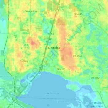
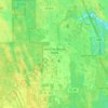
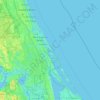
Deltona topographic map

Click on the map to display elevation.

Deltona

The majority of the land in the city is of karst topography, characterized by rolling hills and an abundant amount of lakes. The St. Johns River passes through Lake Monroe, directly south of the city. The United States Geological Survey lists the city's elevation at 33 feet (10 m) above sea level at a point near Deltona's geographic center. Elevations range from 20 feet (6.1 m) to 112 feet (34 m) above sea level. As of 2010, according to the United States Census Bureau, the city has a total area of 41.1 square miles (106.4 km2), 37.5 square miles (97.1 km2) of which is land and 3.5 square miles (9.1 km2) of which is water.

Wikipedia (CC-BY-SA 3.0)

About this map

Name: Deltona topographic map, elevation, terrain.

Location: Deltona, Volusia County, Florida, United States (28.82107 -81.28243 28.96365 -81.15004)

Average elevation: 39 ft

Minimum elevation: -10 ft

Maximum elevation: 121 ft

Volusia County trails, hiking, mountain biking, running and outdoor activities

Other topographic maps

Click on a map to view its topography, its elevation and its terrain.
Osteen

United States > Florida > Volusia County

Average elevation: 39 ft

Allandale

United States > Florida > Volusia County > Port Orange

Average elevation: 10 ft

De Leon Springs

United States > Florida > Volusia County

Average elevation: 56 ft

Ortona

United States > Florida > Volusia County > Daytona Beach

Average elevation: 10 ft

Tomoka Basin

United States > Florida > Volusia County

Average elevation: 3 ft

Kalamazoo

United States > Florida > Volusia County

Average elevation: 23 ft

Deltona

United States > Florida > Volusia County > Deltona

Average elevation: 39 ft

Mound Grove

United States > Florida > Volusia County

Average elevation: 10 ft

Seville

United States > Florida > Volusia County

Average elevation: 43 ft

DeLeon Spring

United States > Florida > Volusia County

Average elevation: 39 ft

Cassadaga

United States > Florida > Volusia County

Average elevation: 66 ft

Louise Lake

United States > Florida > Volusia County > Deltona

Average elevation: 36 ft

Ortona

United States > Florida > Volusia County > Daytona Beach

Average elevation: 10 ft

Osteen

United States > Florida > Volusia County

Average elevation: 39 ft

Packwood Place

United States > Florida > Volusia County

Average elevation: 10 ft

Ariel

United States > Florida > Volusia County > Oak Hill

Average elevation: 10 ft

Cedar Island

United States > Florida > Volusia County

Average elevation: 10 ft

Allandale

United States > Florida > Volusia County > Port Orange

Average elevation: 10 ft

Enterprise

United States > Florida > Volusia County > Enterprise

Average elevation: 23 ft

Barberville

United States > Florida > Volusia County

Average elevation: 39 ft

Gear up for your next adventure:

🥩Freeze-Dried Meals - Nutritious and lightweight food for remote expeditions
📱Solar Portable Charger - Solar power bank for charging devices off‑grid
🪓Survival Multi‑Tool - Versatile tool for camp and trail tasks
🧤Tactile Hiking Gloves - Keep hands warm while operating GPS and smartphone screens
🧭Pro Hiking Compasses - High-accuracy liquid-filled compasses for topographic orientation

As an Amazon Associate, this site earns from qualifying purchases at no extra cost to you.