Geolocate

Macy topographic map

Click on the map to display elevation.

About this map

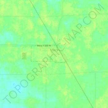
Name: Macy topographic map, elevation, terrain.

Location: Macy, Miami County, Indiana, United States (40.95612 -86.13521 40.96050 -86.12345)

Average elevation: 840 ft

Minimum elevation: 810 ft

Maximum elevation: 860 ft

Miami County trails, hiking, mountain biking, running and outdoor activities

Other topographic maps

Click on a map to view its topography, its elevation and its terrain.

Erie

United States > Indiana > Miami County

Average elevation: 784 ft

Miami

United States > Indiana > Miami County

Average elevation: 807 ft

Gear up for your next adventure:

📷Action Cameras - Rugged cameras to document your journeys across rugged terrain
🚪Portable Camp Chair - Foldable chair for comfort at camp
🧼Biodegradable Camping Soap - Eco‑friendly soap for outdoor hygiene
🌡️Handheld Weather Meters - Measure wind, temp, and pressure for safe mountain travel
🥇GPS Hiking Watch - Multi‑sport GPS watch with navigation and trail tracking

As an Amazon Associate, this site earns from qualifying purchases at no extra cost to you.