Geolocate

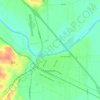
Calvin topographic map

Click on the map to display elevation.

About this map

Name: Calvin topographic map, elevation, terrain.

Location: Calvin, Bastrop County, Texas, United States (30.18744 -97.34727 30.22744 -97.30727)

Average elevation: 446 ft

Minimum elevation: 358 ft

Maximum elevation: 525 ft

Other topographic maps

Click on a map to view its topography, its elevation and its terrain.
Cedar Creek

United States > Texas > Bastrop County

Average elevation: 410 ft

Smithville

United States > Texas > Bastrop County

Average elevation: 328 ft

Elgin

United States > Texas > Bastrop County

Average elevation: 548 ft

Smithville

United States > Texas > Bastrop County

Average elevation: 328 ft

Bastrop

United States > Texas > Bastrop County

Average elevation: 423 ft

Line Creek

United States > Texas > Bastrop County

Average elevation: 427 ft

Gear up for your next adventure:

🥾Hiking Shoes - Durable and comfortable shoes for trail hiking
🚑Emergency Bivvies - Heat-reflective sleeping bags for survival situations
🏕️Tent Footprint - Protect your tent base from wear
🛰️Satellite Messengers - Emergency SOS and two-way messaging for off-grid adventures
🦶Hiking Gaiters - Keep debris and water out of your boots

As an Amazon Associate, this site earns from qualifying purchases at no extra cost to you.