
Fox Run topographic map
Click on the map to display elevation.
About this map
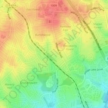
Name: Fox Run topographic map, elevation, terrain.
Average elevation: 689 ft
Minimum elevation: 577 ft
Maximum elevation: 781 ft
Mecklenburg County trails, hiking, mountain biking, running and outdoor activities
Other topographic maps
Click on a map to view its topography, its elevation and its terrain.
Country Roads
United States > North Carolina > Mecklenburg County > Charlotte > Country Roads
Average elevation: 653 ft
Olde Georgetowne
United States > North Carolina > Mecklenburg County > Charlotte
Average elevation: 636 ft
Oakdale Forest
United States > North Carolina > Mecklenburg County > Charlotte
Average elevation: 745 ft