
Make a donation
Gear up for your next adventure:
As an Amazon Associate, this site earns from qualifying purchases at no extra cost to you.
Bunschoten topographic map
Click on the map to display elevation.
Make a donation
Gear up for your next adventure:
As an Amazon Associate, this site earns from qualifying purchases at no extra cost to you.
About this map
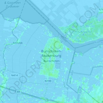
Name: Bunschoten topographic map, elevation, terrain.
Location: Bunschoten, Utrecht, Nederland (52.20553 5.31046 52.28773 5.40464)
Average elevation: -3 ft
Minimum elevation: -20 ft
Maximum elevation: 20 ft
Make a donation
Gear up for your next adventure:
As an Amazon Associate, this site earns from qualifying purchases at no extra cost to you.
Other topographic maps
Click on a map to view its topography, its elevation and its terrain.
Amersfoortse Berg
Nederland > Utrecht > Amersfoort
De zuidwestelijke Amersfoortse wijk Bergkwartier is naar de heuvel vernoemd. Het parkachtige bos op de Amersfoortse Berg wordt Klein Zwitserland genoemd vanwege de voor Nederland vrij grote hoogteverschillen.
Average elevation: 62 ft
Make a donation
Gear up for your next adventure:
As an Amazon Associate, this site earns from qualifying purchases at no extra cost to you.