Geolocate

Wind Cave topographic map

Click on the map to display elevation.

About this map

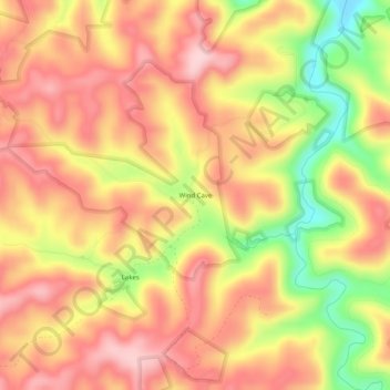
Name: Wind Cave topographic map, elevation, terrain.

Location: Wind Cave, Jackson County, Kentucky, United States (37.49259 -83.94881 37.53259 -83.90881)

Average elevation: 1,119 ft

Minimum elevation: 669 ft

Maximum elevation: 1,394 ft

Jackson County trails, hiking, mountain biking, running and outdoor activities

Other topographic maps

Click on a map to view its topography, its elevation and its terrain.

Annville

United States > Kentucky > Jackson County

Average elevation: 1,178 ft

Annville

United States > Kentucky > Jackson County

Average elevation: 1,178 ft

McKee

United States > Kentucky > Jackson County

Average elevation: 1,266 ft

Gear up for your next adventure:

📌Outdoor GPS Map App - Apps and devices for digital topographic navigation
🌲Outdoor Survival Books - Best books on survival skills
🪶Camp Gear Gift Set - Perfect gift bundle for outdoor fans
🏥Hiking First Aid Kits - Comprehensive medical kits for remote trail injuries
🧦Hiking Socks - Comfortable socks to prevent blisters on long hikes

As an Amazon Associate, this site earns from qualifying purchases at no extra cost to you.