
Town of Alden topographic map
Interactive map
Click on the map to display elevation.
About this map
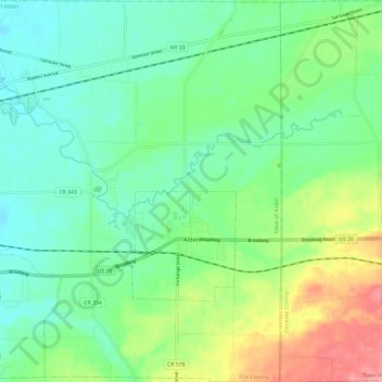
Name: Town of Alden topographic map, elevation, terrain.
Location: Town of Alden, Erie County, New York, 14004, United States (42.86732 -78.57836 42.95469 -78.46381)
Average elevation: 863 ft
Minimum elevation: 758 ft
Maximum elevation: 1,096 ft
Erie County trails, hiking, mountain biking, running and outdoor activities
Other topographic maps
Click on a map to view its topography, its elevation and its terrain.
Onondaga Escarpment
United States > New York > Erie County > Village of Akron
Average elevation: 774 ft