Geolocate

Barada topographic map

Click on the map to display elevation.

About this map

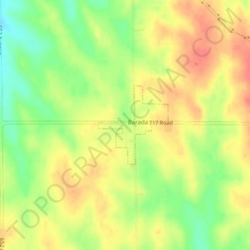
Name: Barada topographic map, elevation, terrain.

Location: Barada, Richardson County, Nebraska, United States (40.21403 -95.58334 40.22252 -95.57351)

Average elevation: 1,122 ft

Minimum elevation: 1,020 ft

Maximum elevation: 1,214 ft

Richardson County trails, hiking, mountain biking, running and outdoor activities

Gear up for your next adventure:

🧣Hiking Neck Gaiter - Multi‑use neck protection for outdoor weather
🌐World Map Poster - Decorative world maps with topographic info
🛠️Outdoor Gear Repair Kit - Essential tools to fix gear on the trail
🩹Survival Bandages - High‑quality bandages for emergencies
🧥Waterproof Jacket for Hiking - Breathable and rugged rain jacket for outdoor excursions

As an Amazon Associate, this site earns from qualifying purchases at no extra cost to you.