Geolocate

Dhayari topographic map

Click on the map to display elevation.

About this map

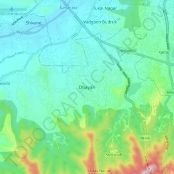
Name: Dhayari topographic map, elevation, terrain.

Location: Dhayari, Haveli, Pune District, Maharashtra, 411041, India (18.39740 73.77904 18.47740 73.85904)

Average elevation: 2,218 ft

Minimum elevation: 1,795 ft

Maximum elevation: 3,747 ft

Other topographic maps

Click on a map to view its topography, its elevation and its terrain.

Moshi Traffic Park

India > Maharashtra > Haveli > Pimpri-Chinchwad

Average elevation: 1,978 ft

Khadakwasla Dam

India > Maharashtra > Haveli > Khadakwasla

Average elevation: 1,932 ft

Ganesh Talav

India > Maharashtra > Haveli > Pimpri-Chinchwad

Average elevation: 1,946 ft

Indrayani river

India > Maharashtra > Haveli > Pimpri-Chinchwad

Average elevation: 1,916 ft

Amanora

India > Maharashtra > Haveli

Average elevation: 1,837 ft

Sentosa Water Park

India > Maharashtra > Haveli > Ravet

Average elevation: 1,893 ft

Bird Valley Lake

India > Maharashtra > Haveli > Pimpri-Chinchwad

Average elevation: 1,949 ft

Moshi Traffic Park

India > Maharashtra > Haveli

Average elevation: 1,978 ft

Mutha

India > Maharashtra > Haveli > Sangrun

Average elevation: 2,201 ft

Sinhagad Fort

India > Maharashtra > Haveli > Kalyan Gaon

Average elevation: 3,264 ft

Moshi Traffic Park

India > Maharashtra > Haveli

Average elevation: 1,978 ft

Gear up for your next adventure:

🌲Outdoor Survival Books - Best books on survival skills
🧤Tactile Hiking Gloves - Keep hands warm while operating GPS and smartphone screens
🎒Waterproof Dry Bags - Keep your electronics and maps dry inside your pack
🕶️GPS Smartphone Mount - Secure mount for phone navigation
🌡️Portable Weather Meter - Track weather conditions on the trail

As an Amazon Associate, this site earns from qualifying purchases at no extra cost to you.