
Thank you for supporting this site ❤️
Make a donation
Make a donation
Gear up for your next adventure:
As an Amazon Associate, this site earns from qualifying purchases at no extra cost to you.
Besal topographic map
Click on the map to display elevation.
Thank you for supporting this site ❤️
Make a donation
Make a donation
Gear up for your next adventure:
As an Amazon Associate, this site earns from qualifying purchases at no extra cost to you.
About this map
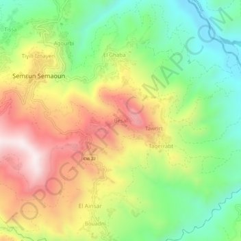
Name: Besal topographic map, elevation, terrain.
Location: Besal, Semaoun, Amizour District, Bejaia, 06020, Algeria (36.58102 4.81939 36.62102 4.85939)
Average elevation: 1,214 ft
Minimum elevation: 246 ft
Maximum elevation: 2,408 ft
Thank you for supporting this site ❤️
Make a donation
Make a donation
Gear up for your next adventure:
As an Amazon Associate, this site earns from qualifying purchases at no extra cost to you.