Geolocate

Knockentiber topographic map

Click on the map to display elevation.

About this map

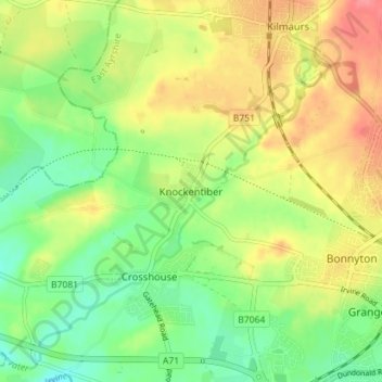
Name: Knockentiber topographic map, elevation, terrain.

Location: Knockentiber, East Ayrshire, Scotland, KA2 0DY, United Kingdom (55.60111 -4.56500 55.64111 -4.52500)

Average elevation: 144 ft

Minimum elevation: 36 ft

Maximum elevation: 276 ft

Other topographic maps

Click on a map to view its topography, its elevation and its terrain.

Glenbuck Loch

United Kingdom > Scotland > East Ayrshire

Average elevation: 1,073 ft

River Doon

United Kingdom > Scotland > East Ayrshire > Dalrymple

Average elevation: 551 ft

River Ayr

United Kingdom > Scotland > East Ayrshire

Average elevation: 689 ft

Braid Wood

United Kingdom > Scotland > East Ayrshire

Average elevation: 374 ft

Loch Doon

United Kingdom > Scotland > East Ayrshire

Average elevation: 955 ft

Gear up for your next adventure:

GPS Sports Watch - GPS watch for running, hiking and training
😴Insulated Sleeping Pads - Compact and warm pads for high-elevation camping
🥤Water Filter Bottle - All‑in‑one filter bottle for safe hydration
🪶Fire Starter Kit - Reliable fire starter for survival and camping
🪵Folding Camp Saw - Compact saw for wood and campsite work

As an Amazon Associate, this site earns from qualifying purchases at no extra cost to you.