
Goat River topographic map
Click on the map to display elevation.
About this map
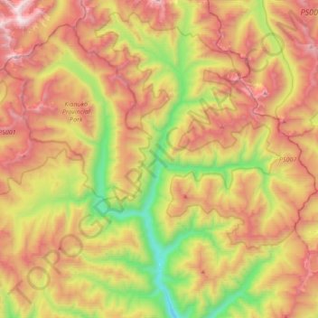
Name: Goat River topographic map, elevation, terrain.
Average elevation: 5,620 ft
Minimum elevation: 2,625 ft
Maximum elevation: 8,917 ft
Other topographic maps
Click on a map to view its topography, its elevation and its terrain.
Kingsgate
Canada > British Columbia > Regional District of Central Kootenay > Area B (Goat River Valley)
Average elevation: 3,212 ft
Kitchener
Canada > British Columbia > Regional District of Central Kootenay > Area B (Goat River Valley)
Average elevation: 3,035 ft
Erickson
Canada > British Columbia > Regional District of Central Kootenay > Area B (Goat River Valley)
Average elevation: 2,231 ft