Geolocate

Atherley topographic map

Click on the map to display elevation.

About this map

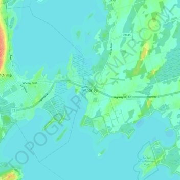
Name: Atherley topographic map, elevation, terrain.

Location: Atherley, Ramara Township, Simcoe County, Central Ontario, Ontario, L3V 1P1, Canada (44.56247 -79.40534 44.64247 -79.32534)

Average elevation: 722 ft

Minimum elevation: 702 ft

Maximum elevation: 840 ft

Other topographic maps

Click on a map to view its topography, its elevation and its terrain.

Lake St. John

Canada > Ontario > Simcoe County > Ramara Township

Average elevation: 722 ft

Gear up for your next adventure:

Solar GPS Watches - Advanced multisport watches with built-in topographic maps
🌎3D Topographic Globes - Raised relief globes for a tactile understanding of geography
🚗GPS Dash Cams - Record your scenic drives through mountain passes and canyons
🌐World Map Poster - Decorative world maps with topographic info
🔦Compact Flashlight - Reliable flashlight for emergencies

As an Amazon Associate, this site earns from qualifying purchases at no extra cost to you.