
Ammersee topographic map
Interactive map
Click on the map to display elevation.
Ammersee
Ammersee (English: Lake Ammer) is a Zungenbecken lake in Upper Bavaria, Germany, southwest of Munich between the towns of Herrsching and Dießen am Ammersee. With a surface area of approximately 47 square kilometres (18 sq mi), it is the sixth largest lake in Germany. The lake is at an elevation of 533 metres (1,749 ft), and has a maximum depth of 81 metres (266 ft). Like other Bavarian lakes, Ammersee developed as a result of the ice age glaciers melting. Ammersee is fed by the River Ammer, which flows as the Amper out of the lake. Like neighbouring Lake Starnberg - deeper, bigger in surface area, similar in shape - it is a popular location for watersports.
About this map
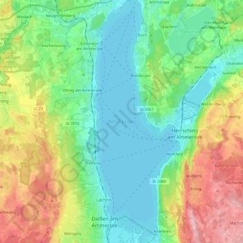
Name: Ammersee topographic map, elevation, terrain.
Average elevation: 1,955 ft
Minimum elevation: 1,742 ft
Maximum elevation: 2,421 ft