
Kemah topographic map
Interactive map
Click on the map to display elevation.
About this map
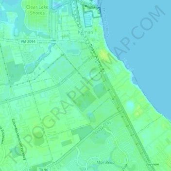
Name: Kemah topographic map, elevation, terrain.
Location: Kemah, Galveston County, Texas, United States (29.51348 -95.03384 29.54944 -95.00169)
Average elevation: 16 ft
Minimum elevation: -7 ft
Maximum elevation: 43 ft
Other topographic maps
Click on a map to view its topography, its elevation and its terrain.
Galveston
United States > Texas > Galveston County
Galveston, Galveston County, Texas, United States
Average elevation: 3 ft
Galveston Island
United States > Texas > Galveston County > Galveston
Galveston Island, Galveston, Galveston County, Texas, 77554, United States
Average elevation: 7 ft
Friendswood
United States > Texas > Galveston County
Friendswood, Galveston County, Texas, 77546, United States
Average elevation: 36 ft
League City
United States > Texas > Galveston County
League City, Galveston County, Texas, 77573, United States
Average elevation: 23 ft
Dickinson
United States > Texas > Galveston County
Dickinson, Galveston County, Texas, 77539, United States
Average elevation: 20 ft
San Leon
United States > Texas > Galveston County
San Leon, Galveston County, Texas, 77395, United States
Average elevation: 3 ft
Gilchrist
United States > Texas > Galveston County
Gilchrist, Galveston County, Texas, 77617, United States
Average elevation: 3 ft
La Marque
United States > Texas > Galveston County
La Marque, Galveston County, Texas, 77568, United States
Average elevation: 13 ft
Tiki Island
United States > Texas > Galveston County
Tiki Island, Galveston County, Texas, United States
Average elevation: 0 ft
Galveston
United States > Texas > Galveston County > Galveston
Galveston, Galveston County, Texas, 77553, United States
Average elevation: 3 ft
Clifton Beach
United States > Texas > Galveston County > Bacliff
Clifton Beach, Bacliff, Galveston County, Texas, 77518, United States
Average elevation: 10 ft
Bacliff
United States > Texas > Galveston County
Bacliff, Galveston County, Texas, 77518, United States
Average elevation: 13 ft
Texas City
United States > Texas > Galveston County
Texas City, Galveston County, Texas, United States
Average elevation: 7 ft
Bolivar Peninsula
United States > Texas > Galveston County
Bolivar Peninsula, Galveston County, Texas, United States
Average elevation: 3 ft
Crystal Beach
United States > Texas > Galveston County
Crystal Beach, Galveston County, Texas, 77650, United States
Average elevation: 3 ft
Bayou Vista
United States > Texas > Galveston County
Bayou Vista, Galveston County, Texas, United States
Average elevation: 7 ft
Texas City
United States > Texas > Galveston County > Texas City > Texas City
Texas City, Galveston County, Texas, 77590, United States
Average elevation: 10 ft
Hitchcock
United States > Texas > Galveston County > Hitchcock > Hitchcock
Hitchcock, Galveston County, Texas, 77563, United States
Average elevation: 16 ft
Hitchcock
United States > Texas > Galveston County
Hitchcock, Galveston County, Texas, 77563, United States
Average elevation: 10 ft
Campeche Cove
United States > Texas > Galveston County > Galveston > Campeche Cove
Campeche Cove, Galveston, Galveston County, Texas, 77552, United States
Average elevation: 7 ft
La Marque
United States > Texas > Galveston County > La Marque > La Marque
La Marque, Galveston County, Texas, 77568, United States
Average elevation: 16 ft
Santa Fe
United States > Texas > Galveston County
Santa Fe, Galveston County, Texas, United States
Average elevation: 26 ft
Clear Lake Shores
United States > Texas > Galveston County
Clear Lake Shores, Galveston County, Texas, United States
Average elevation: 13 ft