Geolocate

Tanque topographic map

Click on the map to display elevation.

About this map

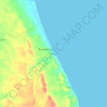
Name: Tanque topographic map, elevation, terrain.

Location: Tanque, Masbate, Bicol Region, Philippines (11.74413 124.04390 11.78413 124.08390)

Average elevation: 72 ft

Minimum elevation: -10 ft

Maximum elevation: 262 ft

Other topographic maps

Click on a map to view its topography, its elevation and its terrain.

Burias

Philippines > Masbate

Average elevation: 59 ft

Gear up for your next adventure:

🧣Merino Neck Gaiters - Multi-functional headwear for wind and sun protection
🎁Geography Themed Gifts - Unique gift ideas for map lovers and geography enthusiasts
🥾Hiking Shoes - Durable and comfortable shoes for trail hiking
🧭Map Reading Tools - Tools and kits for map navigation
🎒Gear Packing Cubes - Organize your backpack efficiently

As an Amazon Associate, this site earns from qualifying purchases at no extra cost to you.