
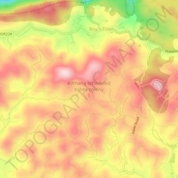
edmana scheduled tribes colony 1 topographic map
Interactive map
Click on the map to display elevation.
About this map
Name: edmana scheduled tribes colony 1 topographic map, elevation, terrain.
Average elevation: 2,510 ft
Minimum elevation: 1,844 ft
Maximum elevation: 2,904 ft
Other topographic maps
Click on a map to view its topography, its elevation and its terrain.
Gurukula Botanical Sanctuary
India > Kerala > Mananthavady > Periya
Gurukula Botanical Sanctuary, Periya - Valad Road, Periya, Mananthavady, Wayanad District, Kerala, 670552, India
Average elevation: 2,480 ft
nedumblassery colony
India > Kerala > Mananthavady
nedumblassery colony, Mananthavady, Wayanad District, Kerala, 670731, India
Average elevation: 2,487 ft
Mazhuvannoor
India > Kerala > Mananthavady > Mazhuvannur
Mazhuvannoor, Mazhuvannur, Mananthavady, Wayanad District, Kerala, India
Average elevation: 2,405 ft
Thalappuzha
India > Kerala > Mananthavady
Thalappuzha, Mananthavady, Wayanad District, Kerala, 670644, India
Average elevation: 2,533 ft
Vellamunda
India > Kerala > Mananthavady > Peechamcode
Vellamunda, Peechamcode, Mananthavady, Wayanad District, Kerala, 670732, India
Average elevation: 2,664 ft
Dwaraka
India > Kerala > Mananthavady
Dwaraka, Mananthavady, Wayanad, Kerala, 670732, India
Average elevation: 2,448 ft
Periya
India > Kerala > Mananthavady
Periya, Mananthavady, Wayanad, Kerala, 670552, India
Average elevation: 2,539 ft
Kattimoola
India > Kerala > Mananthavady
Kattimoola, Mananthavady, Wayanad, Kerala, 670644, India
Average elevation: 2,470 ft
Kattikulam
India > Kerala > Mananthavady > Kattikkulam
Kattikulam, Kattikkulam, Mananthavady, Wayanad, Kerala, India
Average elevation: 2,533 ft
Ellumandam
India > Kerala > Mananthavady
Ellumandam, Mananthavady, Wayanad, Kerala, 670645, India
Average elevation: 2,431 ft
Thrissilery
India > Kerala > Mananthavady > Thrissilery
Thrissilery, Mananthavady, Wayanad, Kerala, 670646, India
Average elevation: 2,657 ft
Mananthavady
India > Kerala > Mananthavady > Mananthavady
Mananthavady, Wayanad, Kerala, 670605, India
Average elevation: 2,464 ft