
Nabay topographic map
Click on the map to display elevation.
Nabay
Nabay (Arabic: نابيه, from the Aramaic: נביא ; ܢܒܺܝܶ̈ܐ) is a village located in the Matn District (kada), Mount Lebanon Governorate (Mohafazat). Nabay is located 16 kilometers (9.9424 mi) away from the capital Beirut. Its elevation is 500 meters (1640.5 ft - 546.8 yd) above sea level. Nabay surface stretches for 388 hectares (3.88 km² - 1.49768 mi²).
About this map
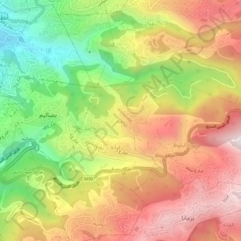
Name: Nabay topographic map, elevation, terrain.
Location: Nabay, Matn District, Mount Lebanon Governorate, 1204, Lebanon (33.87904 35.59888 33.91904 35.63888)
Average elevation: 1,453 ft
Minimum elevation: 62 ft
Maximum elevation: 2,720 ft
Other topographic maps
Click on a map to view its topography, its elevation and its terrain.
Beirut River
Lebanon > Mount Lebanon Governorate
During the Stone Age, the land on which Beirut is now built was two islands in the delta of the Beirut River, but over the centuries the river silted up and the two islands were connected into one land mass. The right bank of the Beirut River, southwest of the mountain resort town of Beit Mery at an altitude…
Average elevation: 2,047 ft