Geolocate

Standing Pine topographic map

Click on the map to display elevation.

About this map

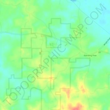
Name: Standing Pine topographic map, elevation, terrain.

Location: Standing Pine, Leake County, Mississippi, United States (32.65355 -89.47337 32.69408 -89.43331)

Average elevation: 417 ft

Minimum elevation: 341 ft

Maximum elevation: 551 ft

Leake County trails, hiking, mountain biking, running and outdoor activities

Other topographic maps

Click on a map to view its topography, its elevation and its terrain.

Redwater

United States > Mississippi > Leake County

Average elevation: 430 ft

Lena

United States > Mississippi > Leake County > Lena

Average elevation: 367 ft

Carthage

United States > Mississippi > Leake County

Average elevation: 384 ft

Gear up for your next adventure:

🔭Compact Binoculars - HD vision for scouting terrain and identifying distant landmarks
🎒Hydration Pack - Hands‑free water reservoir for long hikes
🪶Camping Sleeping Pad - Comfortable sleeping pad for backpacking
👖Convertible Hiking Pants - Versatile zip-off pants for changing altitudes and temperatures
🥄Camping Utensil Set - Lightweight utensils for outdoor meals

As an Amazon Associate, this site earns from qualifying purchases at no extra cost to you.