Geolocate

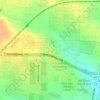
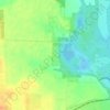
Pilot Point topographic map

Click on the map to display elevation.

About this map

Name: Pilot Point topographic map, elevation, terrain.

Location: Pilot Point, Denton County, Texas, 76258, United States (33.35068 -96.98307 33.42529 -96.83962)

Average elevation: 653 ft

Minimum elevation: 548 ft

Maximum elevation: 751 ft

Denton County trails, hiking, mountain biking, running and outdoor activities

Other topographic maps

Click on a map to view its topography, its elevation and its terrain.

Union Hill

United States > Texas > Denton County

Average elevation: 656 ft

Fort Worth

United States > Texas > Denton County

Average elevation: 699 ft

Hills of Roanoke

United States > Texas > Denton County > Roanoke

Average elevation: 591 ft

Mustang

United States > Texas > Denton County

Average elevation: 597 ft

Parvin

United States > Texas > Denton County > Prosper

Average elevation: 591 ft

Stony

United States > Texas > Denton County

Average elevation: 787 ft

Gear up for your next adventure:

🎒Gear Packing Cubes - Organize your backpack efficiently
⌚Solar GPS Watches - Advanced multisport watches with built-in topographic maps
📷Action Camera - Capture your outdoor adventures in HD
⛺Backpacking Tents - Weight-optimized shelters for multi-day topographic surveys
💧Water Filtration Bottles - Safely drink from streams and lakes while exploring

As an Amazon Associate, this site earns from qualifying purchases at no extra cost to you.