Geolocate

Naaldwijk topographic map

Click on the map to display elevation.

About this map

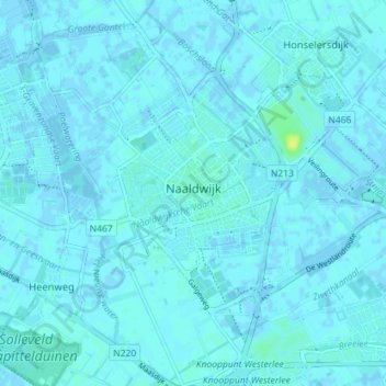
Name: Naaldwijk topographic map, elevation, terrain.

Location: Naaldwijk, Westland, South Holland, Netherlands (51.97045 4.17833 52.01423 4.24914)

Average elevation: 3 ft

Minimum elevation: -10 ft

Maximum elevation: 46 ft

Other topographic maps

Click on a map to view its topography, its elevation and its terrain.

Langeraar

Netherlands > South Holland

Average elevation: -10 ft

Broekhuizen

Netherlands > South Holland > Gouda

Average elevation: -3 ft

Ankerpark

Netherlands > South Holland > Leiden

Average elevation: 10 ft

Botlek

Netherlands > South Holland

Average elevation: 10 ft

Middelsluis

Netherlands > South Holland > Numansdorp

Average elevation: 0 ft

Meije

Netherlands > South Holland > Nieuwkoop

Average elevation: -7 ft

Weerestein

Netherlands > South Holland > Hillegom

Average elevation: 0 ft

Weerestein

Netherlands > South Holland > Hillegom

Average elevation: 0 ft

Meijendel

Netherlands > South Holland > Wassenaar

Average elevation: 20 ft

Coepelduynen

Netherlands > South Holland > Katwijk

Average elevation: 13 ft

Het Park

Netherlands > South Holland > Rotterdam

Average elevation: 13 ft

Waalhaven

Netherlands > South Holland > Rotterdam

Average elevation: 10 ft

Gear up for your next adventure:

💧Water Purification System - Clean water on the trail with reliable purifiers
🔭Telescopic Hiking Pole - Adjustable pole for hiking stability
🏫Relief Map Kits - Hands-on tools for teaching landforms and elevation
🧣Hiking Neck Gaiter - Multi‑use neck protection for outdoor weather
🥤Water Filter Bottle - All‑in‑one filter bottle for safe hydration

As an Amazon Associate, this site earns from qualifying purchases at no extra cost to you.