
半塔镇 topographic map
Interactive map
Click on the map to display elevation.
About this map
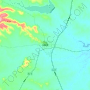
Name: 半塔镇 topographic map, elevation, terrain.
Location: 半塔镇, 滁州市, 安徽省, 中国 (32.63767 118.54340 32.71767 118.62340)
Average elevation: 171 ft
Minimum elevation: 79 ft
Maximum elevation: 561 ft
Other topographic maps
Click on a map to view its topography, its elevation and its terrain.