Geolocate

Aerial topographic map

Click on the map to display elevation.

About this map

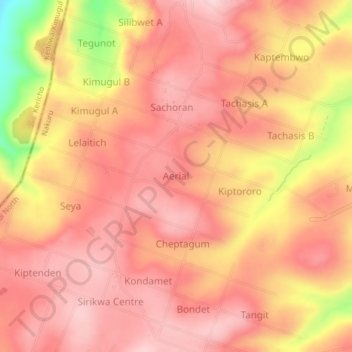
Name: Aerial topographic map, elevation, terrain.

Location: Aerial, Kuresoi North, Nakuru, Kenya (-0.28638 35.64834 -0.24638 35.68834)

Average elevation: 8,871 ft

Minimum elevation: 8,337 ft

Maximum elevation: 9,078 ft

Gear up for your next adventure:

📷Action Cameras - Rugged cameras to document your journeys across rugged terrain
🧤Tactile Hiking Gloves - Keep hands warm while operating GPS and smartphone screens
🛏️Cold Weather Sleeping Bag - Warm sleeping bag for cold conditions
🌄Hiking Binoculars - Compact binoculars for scenic views and trail spotting
📶Satellite Messenger - Communication device off‑grid

As an Amazon Associate, this site earns from qualifying purchases at no extra cost to you.