
Paterson topographic map
Click on the map to display elevation.
About this map
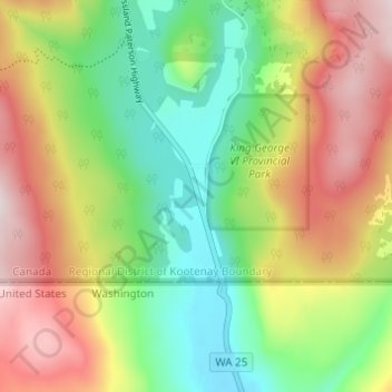
Name: Paterson topographic map, elevation, terrain.
Average elevation: 2,920 ft
Minimum elevation: 2,126 ft
Maximum elevation: 3,970 ft
Other topographic maps
Click on a map to view its topography, its elevation and its terrain.
Rossland Range Recreation Site
Canada > British Columbia > Regional District of Kootenay Boundary > Area B (Lower Columbia/Old Glory)
Average elevation: 4,764 ft