
Siorapaluk topographic map
Interactive map
Click on the map to display elevation.
About this map
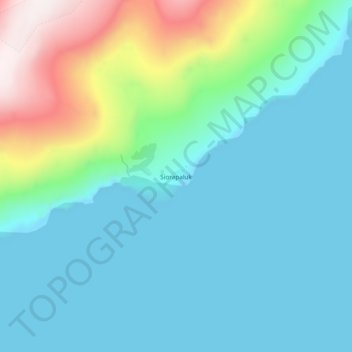
Name: Siorapaluk topographic map, elevation, terrain.
Location: Siorapaluk, Avannaata, Greenland (77.76543 -70.65338 77.80543 -70.61338)
Average elevation: 554 ft
Minimum elevation: 0 ft
Maximum elevation: 2,854 ft
Other topographic maps
Click on a map to view its topography, its elevation and its terrain.
Jakobshavn Glacier
Jakobshavn Glacier, Avannaata, Greenland
Average elevation: 1,483 ft
Upernivik Island
Upernivik Island, Avannaata, Greenland
Average elevation: 1,969 ft