
Sermilik Fjord topographic map
Interactive map
Click on the map to display elevation.
About this map
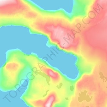
Name: Sermilik Fjord topographic map, elevation, terrain.
Location: Sermilik Fjord, Avannaata, Greenland (70.60739 -51.09814 70.68864 -50.63796)
Average elevation: 1,148 ft
Minimum elevation: -10 ft
Maximum elevation: 3,202 ft
Other topographic maps
Click on a map to view its topography, its elevation and its terrain.
Jakobshavn Glacier
Jakobshavn Glacier, Avannaata, Greenland
Average elevation: 1,483 ft
Upernivik Island
Upernivik Island, Avannaata, Greenland
Average elevation: 1,969 ft