
Tidewater topographic map
Click on the map to display elevation.
About this map
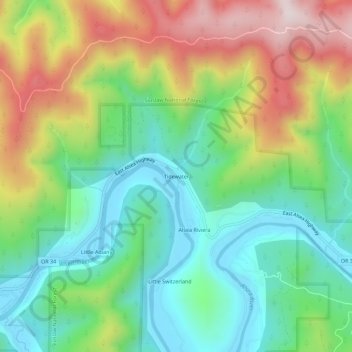
Name: Tidewater topographic map, elevation, terrain.
Location: Tidewater, Lincoln County, Oregon, 97390, United States (44.39178 -123.92156 44.43178 -123.88156)
Average elevation: 728 ft
Minimum elevation: -13 ft
Maximum elevation: 1,988 ft
Lincoln County trails, hiking, mountain biking, running and outdoor activities
Other topographic maps
Click on a map to view its topography, its elevation and its terrain.
Seal Rock State Recreation Site
United States > Oregon > Lincoln County > Seal Rock
Average elevation: 52 ft