
Pu’er topographic map
Interactive map
Click on the map to display elevation.
About this map
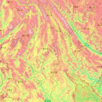
Name: Pu’er topographic map, elevation, terrain.
Location: Pu’er, Yunnan, 665000, China (22.02597 99.15619 24.82523 102.32353)
Average elevation: 4,852 ft
Minimum elevation: 1,263 ft
Maximum elevation: 11,342 ft
Other topographic maps
Click on a map to view its topography, its elevation and its terrain.
玉龙雪山
China > Yunnan > 丽江市 Lijiang
玉龙雪山, Yulong, 丽江市 Lijiang, Yunnan, China
Average elevation: 15,843 ft
Roter Fluss
Roter Fluss, 金平苗族瑶族傣族自治县 (Jinping), 红河州:红河, Yunnan, 661300, China
Average elevation: 3,609 ft