Geolocate
👉 Easily get elevation data in JSON, GeoTIFF and KML formats using Elevation API
Thank you for supporting this site ❤️
Make a donation

Bangor topographic map

Click on the map to display elevation.

About this map

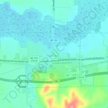
Name: Bangor topographic map, elevation, terrain.

Location: Bangor, La Crosse County, Wisconsin, United States (43.88439 -91.01056 43.90250 -90.97064)

Average elevation: 755 ft

Minimum elevation: 699 ft

Maximum elevation: 974 ft

La Crosse County trails, hiking, mountain biking, running and outdoor activities

Other topographic maps

Click on a map to view its topography, its elevation and its terrain.

Medary

United States > Wisconsin > La Crosse County > La Crosse

Average elevation: 741 ft

Midway

United States > Wisconsin > La Crosse County

Average elevation: 702 ft

La Crosse

United States > Wisconsin > La Crosse County > La Crosse

Average elevation: 896 ft

Mindoro

United States > Wisconsin > La Crosse County

Average elevation: 876 ft

Saint Joseph

United States > Wisconsin > La Crosse County

Average elevation: 1,165 ft

Gear up for your next adventure:

🪵Folding Camp Saw - Compact saw for wood and campsite work
🔥Camping Stove - Portable stove for camping and backcountry cooking
🪶LED Camping Lantern - Bright lantern for camp lighting
🎒Trail Energy Bars - High‑calorie bars for hiking energy
🛡️Bear Spray Outdoor - Protection in bear country hikes

As an Amazon Associate, this site earns from qualifying purchases at no extra cost to you.