Geolocate

Balzac topographic map

Click on the map to display elevation.

About this map

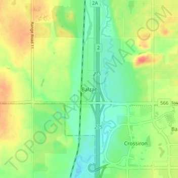
Name: Balzac topographic map, elevation, terrain.

Location: Balzac, Rocky View County, Alberta, T0M 0E0, Canada (51.19561 -114.02456 51.23561 -113.98456)

Average elevation: 3,570 ft

Minimum elevation: 3,497 ft

Maximum elevation: 3,665 ft

Gear up for your next adventure:

📚Navigation Handbooks - Master the art of reading topographic maps and using a compass
🧭Outdoor Navigation Book - Learn advanced navigation skills
🪶Survival Guide Book - Expert advice for emergency preparedness
📡GPS Antenna Upgrade - Enhance GPS reception in remote terrain
🔭Compact Binoculars - HD vision for scouting terrain and identifying distant landmarks

As an Amazon Associate, this site earns from qualifying purchases at no extra cost to you.