
Maria Neustift topographic map
Interactive map
Click on the map to display elevation.
Maria Neustift
Hauptort der Gemeinde ist das Dorf Maria Neustift. Es befindet sich 19 Kilometer südöstlich von Steyr und 13 km südwestlich von Waidhofen an der Ybbs. Es liegt auf einem Riedel zwischen dem Neustiftgraben im Süden und dem Höllgraben im Norden, auf um die 610 m ü. A. Höhe. Der Ort umfasst gut 110 Adressen. Er gehört zur Katastralgemeinde Buchschachen.
About this map
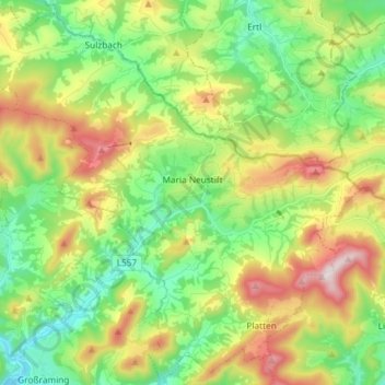
Name: Maria Neustift topographic map, elevation, terrain.
Location: Maria Neustift, Bezirk Steyr-Land, 4443, Österreich (47.88628 14.52400 47.98161 14.67070)
Average elevation: 2,080 ft
Minimum elevation: 1,217 ft
Maximum elevation: 3,583 ft
Other topographic maps
Click on a map to view its topography, its elevation and its terrain.