Geolocate

Waterloo topographic map

Click on the map to display elevation.

About this map

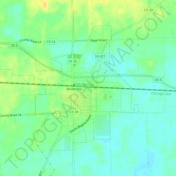
Name: Waterloo topographic map, elevation, terrain.

Location: Waterloo, DeKalb County, Indiana, United States (41.41897 -85.05314 41.44326 -85.00766)

Average elevation: 906 ft

Minimum elevation: 873 ft

Maximum elevation: 955 ft

DeKalb County trails, hiking, mountain biking, running and outdoor activities

Other topographic maps

Click on a map to view its topography, its elevation and its terrain.

Spencerville

United States > Indiana > DeKalb County

Average elevation: 817 ft

Stafford Center

United States > Indiana > DeKalb County

Average elevation: 846 ft

Gear up for your next adventure:

🔥Camping Stove - Portable stove for camping and backcountry cooking
🛠️Outdoor Gear Repair Kit - Essential tools to fix gear on the trail
🛡️Insect Repellent - Protection against bugs during outdoor activities
🚪Portable Camp Chair - Foldable chair for comfort at camp
🦶Carbon Trekking Poles - Reduce knee impact on steep descents with ultra-light poles

As an Amazon Associate, this site earns from qualifying purchases at no extra cost to you.